2012-12-28 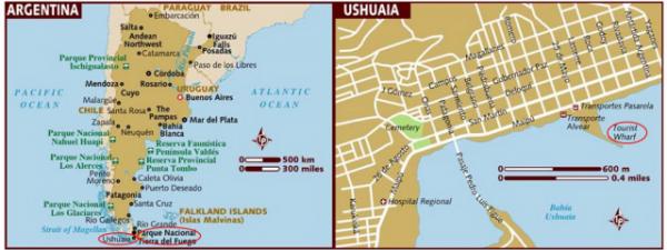
【Aiden in English】
By December, a hot summer had come to the south. However, the cold still numbed my teeth as we waited on the sun deck for the glaciers and sheer mountains to appear over the horizon in the Strait of Magellan, which separates the Pacific Ocean from the Atlantic Ocean. Due to tidal constraints, we had to delay our arrival time by two hours in Ushuaia, Argentina, this afternoon. Unexpectedly, Glacier Alley became our retreat. The cruise glided to Beagle Channel, named after the ship that carried the English naturalist Charles Darwin on a five-year voyage around the tip of South America. Glaciers Alley boasted a passage lined with spectacular hanging glaciers, icy rivers, dancing waterfalls, and granite walls on each side. Spain, Romania, Germany, Italy, France, the Netherlands, and others were represented by each of the 12 glaciers in European colonial flavors. As the first stupendous glacier came into view, all my drowsiness melted away, replaced immediately by stunning awe. The natural surroundings here evoked a feeling of infinite peace, making me feel as though I was reliving the Ice Age again. The immense silence didn't seem interrupted until the creaks of glacier movement took place, and the waterfalls splashed into the alley. We soaked up the marvelous scenery and inhaled the fresh sea air, accompanied by a pleasant breeze. The glaciers were so large that I doubted five "Star Princess" cruise ships would fill half the ice. But something didn't sound quite right. Thin icicles were hanging down. The ice was melting slowly, and a tiny piece of ice carved off the glacier instantly turned into water. Just like the others, tiny chunks were nibbled away by growing heat. I no longer needed my heavy coat. When we finally sat down for lunch, I ordered some random items from the menu. The spicy soup tasted more like a sandwich and turned out messy, but I wasn't hungry. I was excited about going to any dry land again. Before I knew it, I boarded a tour bus to drive to the end of the world—Ushuaia, Argentina. Ushuaia was a former Argentine penal colony. Now, it proudly serves as the southernmost city in the world and a gateway to the wilderness in Argentina and Antarctica. Looking out the window through the Martial Mountains, whose glaciers reshaped the river pathway into a U-shaped valley, I spotted a small clearing where no popular beaches but stumps grew in Tierra del Fuego (Land of Fire) National Park. The beavers built up their community around the Pipo riverside and peat bogs. A stack of roughly cut logs was neatly arranged to form a dam. The dam was already a speck among the trees and mushrooms. "Wait, mushroom?" I thought. Small yellow peach-like mushrooms the size of my thumb were dotted with entangled twigs. Just at that moment, the tour guide pointed at them and gave a quick reference about them. They were edible Darwin fungi and had a nickname of "Indian Bread." They lived in the trees all the time. Chinese lanterns (Mizodendrum punctatum) set up another example of hemiparasitically living on deciduous trees. Whether the host trees were happy with these "lanterns" or not, they bundled in a colorful patch like the land of fire. Nearby, a single duck waded across the water as we passed by a small creek toward its nest in the center. We ran into a red fox that was patrolling this area haughtily. I wondered how they coexisted peacefully. Lake Fagnano was divided into parts and shared by Argentina and Chile along the unpaved road. Wild and snow-capped Andes Mountains began to appear high up on the surrounding slopes. Rivers carved V-shaped valleys as they passed over the land. Then, we headed to the end-of-the-world post office in Ensenada Bay, along the Beagle Channel. The owner was the only man to greet a crowd of visitors worldwide and stamp tons of End-of-World postcards daily. Beagle Channel looked longer than the naked eye could see. Soon, we were immersed in the beauty of glaciers plummeting to the icy water and the ever-changing island panorama in the backdrop. We made our last stop in Lapataia Bay on the Pan-American Highway, an astounding marvel of civil engineering that began in Alaska and stretched nearly 29,800 miles/47,958 kilometers across two continents. Guinness's Book of World Records listed the highway as the world's longest "passable road." If one biked from Alaska to Ushuaia, it would take at least 1.5 years to reach the world's end. I wondered what type of manic would do such a thing. As a light rain began to fall, it was time for us to cruise away. We knew that we would come back again. Next time, we will surely take an Icebreaker from Ushuaia to Antarctica instead of a flight! 【红霞译】
时下临近十二月底,酷暑正席卷南半球,然而当清晨站在甲板上随船从太平洋朝大西洋方向穿越麦哲伦“巨大”海峡时,我牙齿打颤,浑身上下被冻得僵硬。 因为潮汐关系,我们不得不推迟下午靠岸时间,即延后两个小时抵达号称世界尽头的阿根廷“银色之地”乌斯怀亚“深海湾”城,这么一来,事先未列入计划的智利“土地的尽头”冰川巷出人意料地出现在我们的行程之中。游轮沿比格犬“小猎犬”海峡行驶,那条水路得名于当年英国博物学家查尔斯•达尔文五年环南美航行考察所乘坐的“比格犬号”,位于比格犬海峡上的冰川巷由十二个冰川组成,每一个冰川则以欧洲殖民国家命名,悬垂的冰川、浪漫的冰河、舞动的瀑布以及挺拔的高山,使得两侧西班牙冰川、瑞士罗曼什冰川、德意志冰川、意大利冰川、法兰西冰川、荷兰冰川等更加奇特迷人。
随着第一座冰川映入眼帘,我立刻睡意全无,满脸充满惊喜,大自然洋溢着永恒祥和的气息,仿佛带我重新回到“冰期”时代。整个冰川巷万籁俱寂,唯有当冰块移动时而造成的断裂声或者瀑布跌落时而发出的拍打声才偶尔敲碎深沉的宁静,我们陶醉在宛如仙境的景致当中,深感波浪轻快空气宜人。眼前冰川如此之大,我怀疑即使五艘“公主•星辰” 号游轮也装不下它,这时周围好像有什么不对头,很多冰柱列队倒挂,冰晶慢慢溶化,一点一滴地变成水珠,气温回升涣然冰释,我也随之脱掉了穿在身上的厚外套。
午餐时我随便点了些东西,辣汤味道偏酸,三明治吃得乱七八糟,反正我一点不饿,倒是十分期待找个干燥的地方呆着,未容细想,我已经坐上开往世界尽头阿根廷深湾城的旅游大巴。 深湾城过去曾为流放重刑罪犯的荒郊野岭,现在不仅是众人向往的世外桃源,而且还成为阿根廷内陆和南极洲极地探险的交通枢纽。
进入阿根廷火地岛国家公园内,我透过车窗遥望威武山脉,U形山谷俨然是冰川融化后长期雕饰的杰作,周边有一大片荒地,几乎见不到该地区普遍流行的山毛榉,被折断的树桩横七竖八堆躺在皮泊河边及沼泽地上,原来水獭常年在这里筑坝修堤安营扎寨,蚕食了许多本来可以长大成材的树林。 “瞧一瞧,那是蘑菇吗?”形如桃样的黄色蘑菇簇拥在树枝树干上下,大小跟我拇指差不多。正在此时,导游指着解释道,它们可作食用,学名叫达尔文真菌,俗称“印度面包”,喜欢与山毛榉结伴同生。
“中国灯笼”善于半寄生地打坐在落叶乔木上,不管宿主乐意不乐意,“灯笼”高吊枝头,红一片、黄一片、青一片,如火如荼,非常好看。
附近不远,一只鸭子正朝水中游去,它的老窝筑在我们刚刚经过的小溪中央,途中我们恰巧遇到一只红狐狸旁若无人地穿过马路,不知两个家伙怎样和平共处?
暗湖位于土路尽端,智利与阿根廷两国各居一侧平分秋色,远处视野间,奔放雄伟终年积雪的安第斯“高耸的山脊”山脉层峦叠嶂,各支河流争相在山峦间切割出一条V型峡谷。 比格犬海峡山上有一所邮局可谓盖世无双,老板是独一无二的雇员,每天不仅接待来自世界各地大量的游客,还要给无数张明信片加盖“世界尽头”纪念邮戳。比格犬海峡一眼望不到头,跟着它一路走一路瞧,我们不觉沉醉于寒冷刺骨景色旖旎的奇山异岛之中而不能自拔。
最后,我们鉴赏了火地岛罗非鱼湾畔的泛美公路,这条举世瞩目的交通干线北起美国阿拉斯加,南至阿根廷深湾城,横亘北美和南美两大地域,全长共达29,800 英里/47,958公里,作为全世界最长的可以通行的公路被纳入《吉尼斯世界纪录大全》,假如有人要骑自行车越野穿行的话,恐怕至少需要一年半的时间,我想象不出何许狂人会作出这等壮举。 小雨乍起,我们也该返程了。深湾城,我们后会有期,相信不久的将来探险南极时我们定会到这里专乘破冰船而不再坐飞机,因为依赖天气主宰命运的航行实在不靠谱!
Today in History(历史上的今天): 2010: 节日串连(Holiday Connection)
2009: 骑在羊背上的国家(Riding on Sheep's Back) 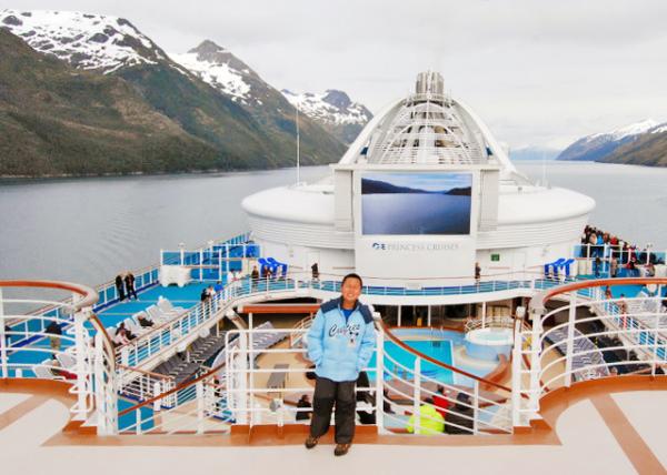 Star Princess through Glacier Alley, a Stretch of the 150-Mile/241-Km-long Beagle Channel in Southern Chile Star Princess through Glacier Alley, a Stretch of the 150-Mile/241-Km-long Beagle Channel in Southern Chile
(“公主·星辰”号游轮穿行冰川巷——智利南部长达150英里/241公里的比格犬海峡 12-28-2012) 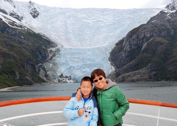 Romanche Glacier in Tierra del Fuego, Beagle Channel, Alberto de Agostini National Park Romanche Glacier in Tierra del Fuego, Beagle Channel, Alberto de Agostini National Park
(罗曼什“瑞士”冰川——位于火地岛比格尔海峡阿尔贝托·阿戈斯蒂尼“高贵而明亮·庄严”国家公园 12-28-2012) 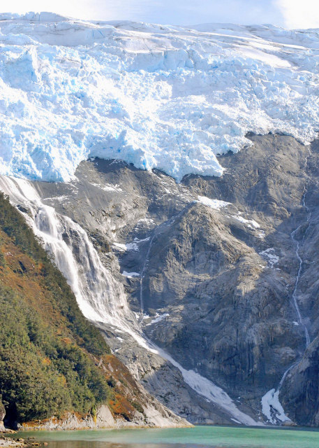
Hanging Tidewater Glaciers @ Alemania Glacier, Patagonia (巴塔哥尼亚阿莱马尼亚“德国”冰川·垂悬潮水冰川) 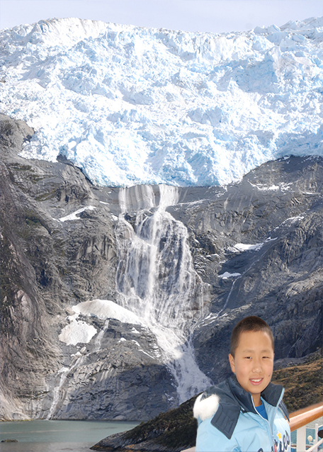
Espana Glacier Dumping Water into Beagle Channel (西班牙冰川向比格尔海峡倾泻水流 12-28-2012) 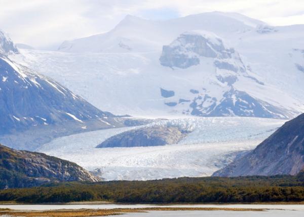 Glacier Alley from Darwin Ice Field on Isla Grande to the Sea Glacier Alley from Darwin Ice Field on Isla Grande to the Sea
(冰川巷·从火地岛达尔文“亲爱的朋友”冰原到大海) 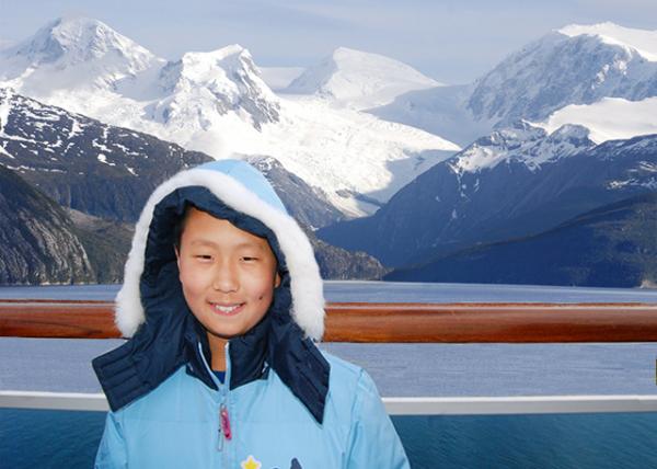 Cordillera Darwin Located in the Southwestern Portion of Isla Grande de Tierra del Fuego Cordillera Darwin Located in the Southwestern Portion of Isla Grande de Tierra del Fuego
(达尔文山脉·位于火地岛西南部,完全位于智利境内 12-28-2012) 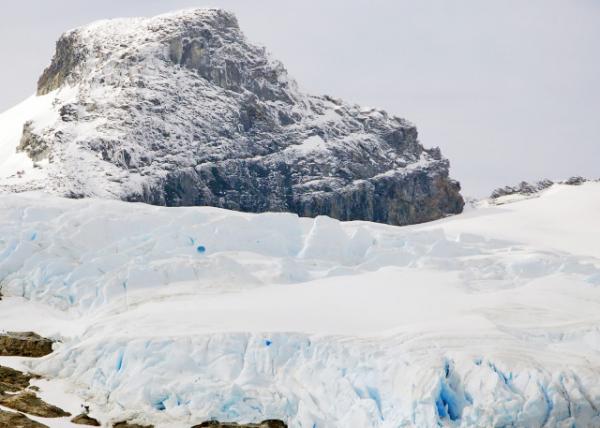 Glacier Alley, Snow-capped Darwin Range Glacier Alley, Snow-capped Darwin Range
(冰川巷·白雪覆盖的达尔文山脉) 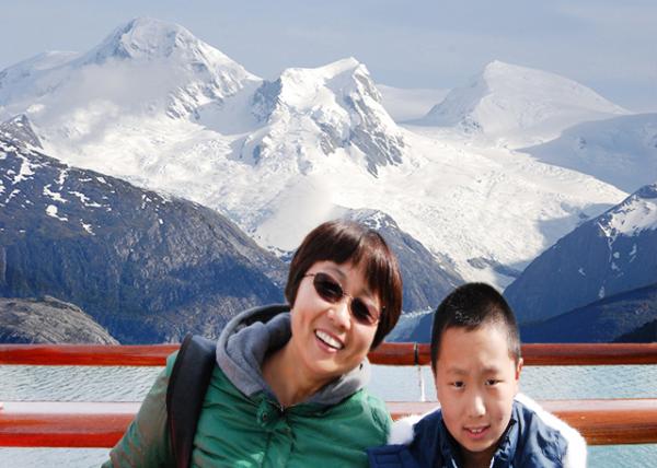 Massive Glaciers & the Fjords in Southern Patagonia in Chile far from the Antarctic Water Massive Glaciers & the Fjords in Southern Patagonia in Chile far from the Antarctic Water
(巨大的冰川和峡湾·远离南极水域的智利巴塔哥尼亚“大脚之地”南部 12-28-2012) 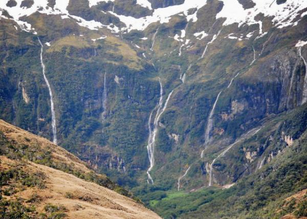 Glacier Alley, the Patagonian Fjordlands Glacier Alley, the Patagonian Fjordlands
(冰川巷·巴塔哥尼亚峡湾) 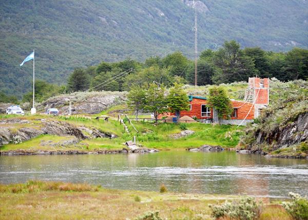 Border Between Argentina & Chile Border Between Argentina & Chile
(阿根廷与智利国界) 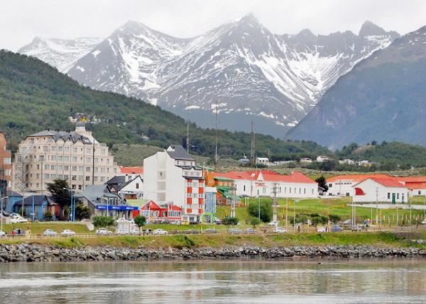 Ushuaia Located in the Tierra del Fuego Archipelago Ushuaia Located in the Tierra del Fuego Archipelago
(乌斯怀亚·位于火地岛半岛) 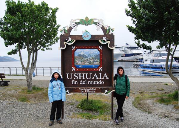 Ushuaia, the World's Southernmost City Ushuaia, the World's Southernmost City
(乌斯怀亚·世上最南端的城市 12-28-2013) 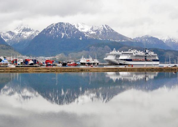 Martial Mountains of Ushuaia Martial Mountains of Ushuaia
(乌斯怀亚·马尔斯“战神”山脉)
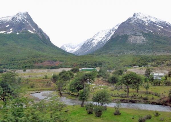
U-Shape Valley of Martial Mtns in Ushuaia
(乌斯怀亚·马尔斯山脉U形山谷) 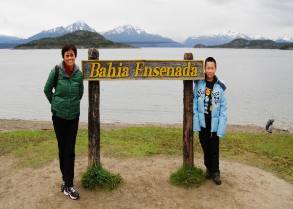 Bahía Encerrada, Protecting Basins & Coasts & Preserving Wild Species as a Green Lung Bahía Encerrada, Protecting Basins & Coasts & Preserving Wild Species as a Green Lung
(恩塞拉达“闭合”湾·如同绿肺,守护着盆地和海岸并保护着野生物种 12-28-2012) 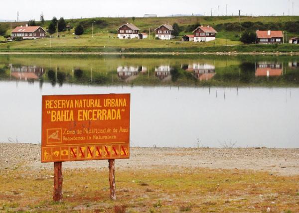 Bahía Encerrada Natural Reserve of Ushuaia Bahía Encerrada Natural Reserve of Ushuaia
(乌斯怀亚·恩塞拉达湾自然保护区) 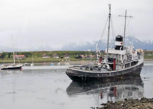 Wreck of the Saint Christopher (HMS Justice) aground in the Harbor of Ushuaia Wreck of the Saint Christopher (HMS Justice) aground in the Harbor of Ushuaia
(圣克里斯托弗“基督承载者”号 | 正义号残骸·搁浅在乌斯怀亚港) 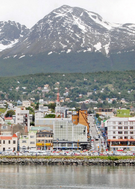
Downtown Ushuaia (乌斯怀亚·市中心) 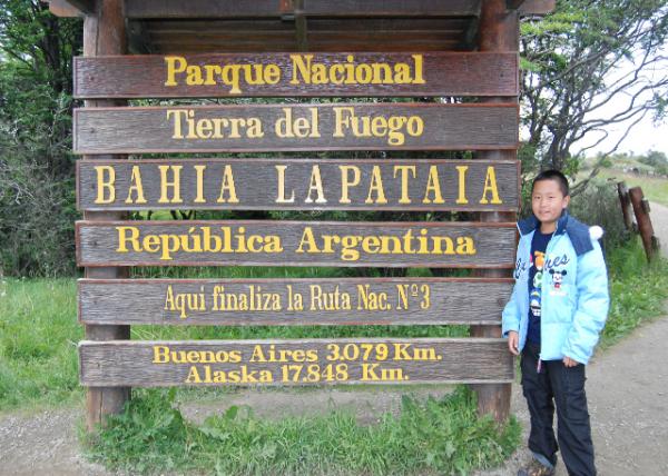 Tierra del Fuego NP @ the End of the World Tierra del Fuego NP @ the End of the World
(火地岛国家公园·位于世界尽头 12-28-2012)
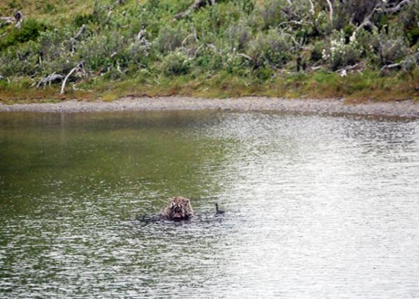 Duck Nested in a River Center @ Tierra del Fuego NP Duck Nested in a River Center @ Tierra del Fuego NP
(火地岛国家公园·建在河中心的鸭窝)
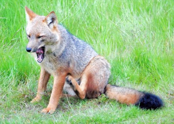 Red Fox Eyes Ducks in the River @ Tierra del Fuego NP Red Fox Eyes Ducks in the River @ Tierra del Fuego NP
(火地岛国家公园·觊觎河鸭的红狐狸) 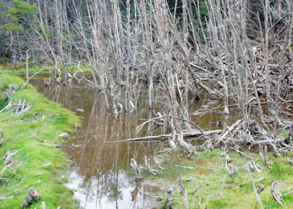 Beaver Home @ Tierra del Fuego NP Beaver Home @ Tierra del Fuego NP
(火地岛国家公园·河狸老巢) 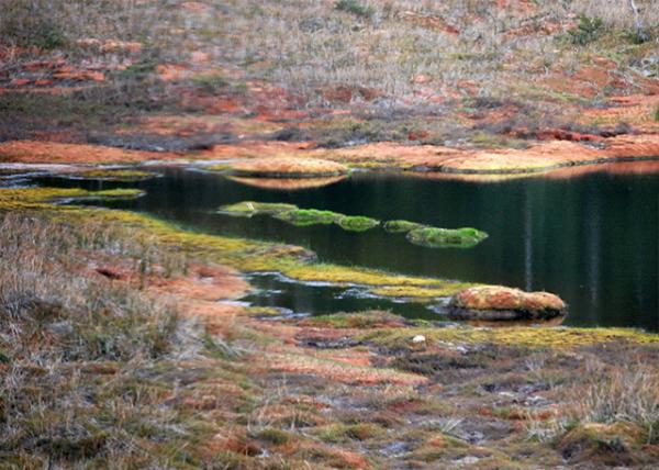 Iron-Containing Colorful Creek @ Tierra del Fuego NP Iron-Containing Colorful Creek @ Tierra del Fuego NP
(火地岛国家公园·含铁的多彩小溪)
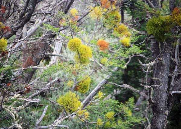 Chinese Lanterns @ Tierra del Fuego NP Chinese Lanterns @ Tierra del Fuego NP
(火地岛国家公园·中国灯笼) 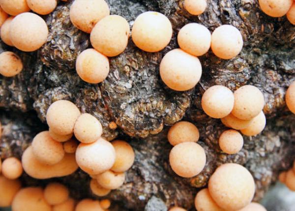 Indian Bread @ Tierra del Fuego NP Indian Bread @ Tierra del Fuego NP
(火地岛国家公园·印度面包)
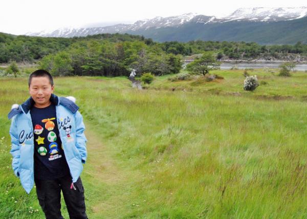 Chile in Distance across Tierra del Fuego NP Chile in Distance across Tierra del Fuego NP
(火地岛国家公园对面的智利 12-28-2012) 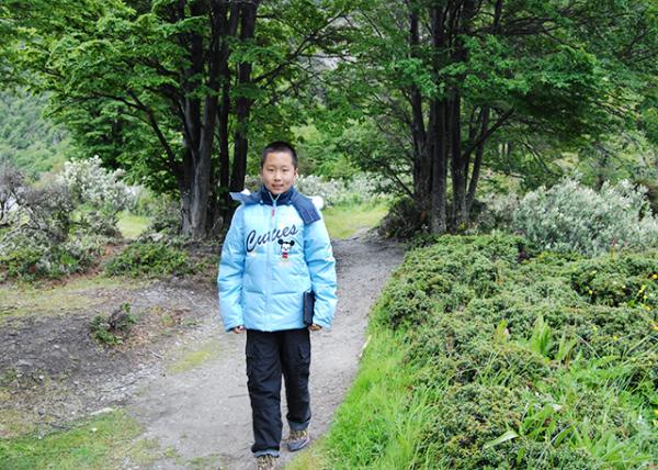 Trail to Lago Roca @ Tierra del Fuego NP Trail to Lago Roca @ Tierra del Fuego NP
(火地岛国家公园·通往岩石湖的步道 12-28-2012)  Lago Roca @ Tierra del Fuego NP Lago Roca @ Tierra del Fuego NP
(火地岛国家公园·岩石湖 12-28-2012)
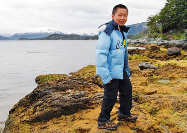 Lapataia Bay @ Tierra del Fuego NP Lapataia Bay @ Tierra del Fuego NP
(火地岛国家公园·拉帕塔亚“森林湾” 12-28-2012)
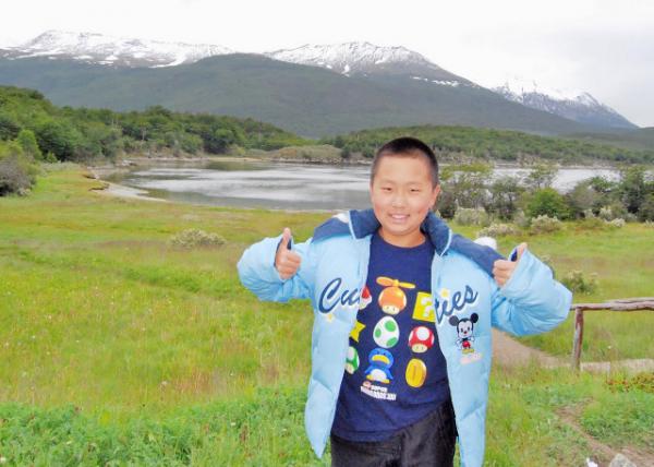 Southernmost Pan-American Highway @ Lapataia Bay Southernmost Pan-American Highway @ Lapataia Bay
(拉帕塔亚湾·泛美高速公路最南端 12-28-2012) 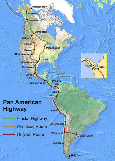
Pan-American Highway (泛美高速公路线) 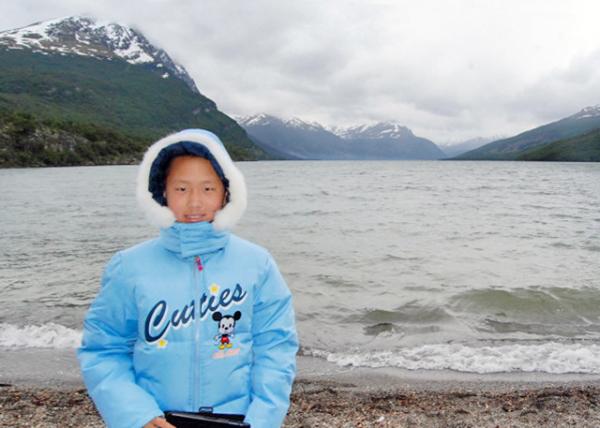 V-shaped Valleys along Fagnano Lake of @ Lapataia Bay V-shaped Valleys along Fagnano Lake of @ Lapataia Bay
(拉帕塔亚湾·V型峡谷 12-28-2012) 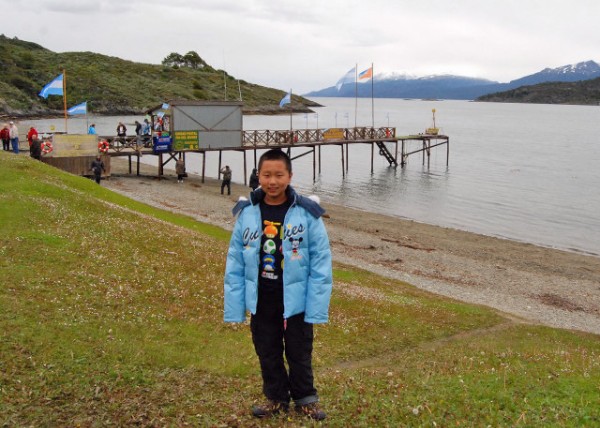
The End-of-World Post Office @ Lapataia Bay (拉帕塔亚湾·世界尽头邮局 12-28-2012) 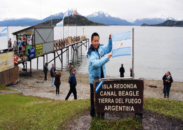 Isla Redonda, Located @ Canal Beagle, Tierra Del Fuego Isla Redonda, Located @ Canal Beagle, Tierra Del Fuego
(雷东达“圆形”岛·位于火地岛比格尔海峡 12-28-2012)
 Beagle Channel @ Tierra del Fuego NP Beagle Channel @ Tierra del Fuego NP
(火地岛国家公园·比格犬海峡 12-28-2012) 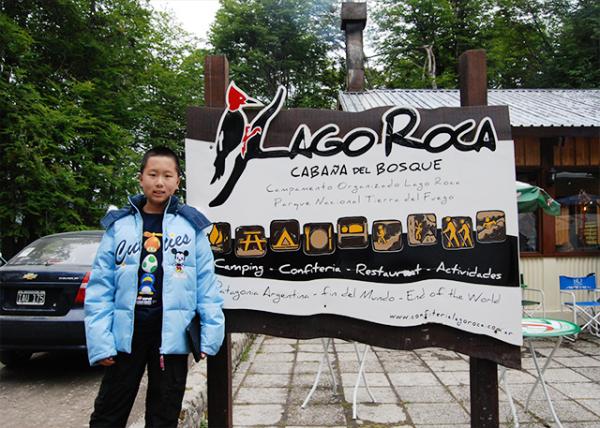 Lago Roca Cabana del Bosque @ Tierra del Fuego NP Lago Roca Cabana del Bosque @ Tierra del Fuego NP
(火地岛国家公园·罗卡“岩石”湖森林小屋 12-28-2012)  Play Piano @ Star Princess Play Piano @ Star Princess
(“公主·星辰”号游轮——玩钢琴 12-28-2012)  Dinner @ Star Princess Dinner @ Star Princess
(“公主·星辰”号游轮——晚餐 12-28-2012) Crosslinks(相关博文): Chile(出游智利)
Argentina(出游阿根廷) South America(漂流南美洲) 小学四年级(4th Grade) |
